| Uncovering complex star dune dynamics using dense spatiotemporal 3D monitoring | Manuel Herzog,
Katharina Anders | | | |
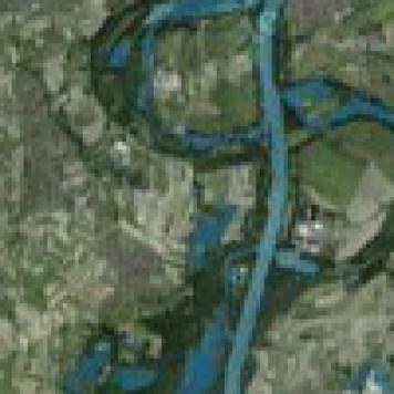
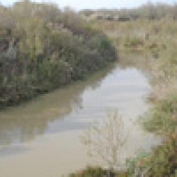
| Die Flusslandschaft der Weschnitz
Ihre Wechselwirkung mit dem Kloster Lorsch | Thomas Becker,
Olaf Bubenzer,
Bertil Mächtle,
Udo Recker,
Gerrit Schenk,
Andreas Vött | | | |
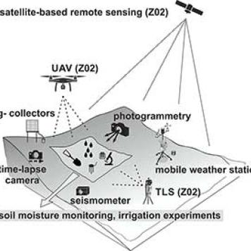
| Ground based observations and experiments | Olaf Bubenzer,
Georg Bareth | | | |
| The last formation
Dating recrystallisation events of evaporites using lyoluminescence | Magdalena Biernacka,
Olaf Bubenzer,
Sebastian Kreutzer | | | |
| Pilot study to evaluate the potential of the Anib and Arasab pan as palaeoenvironmental archive in the southern Namib Desert | Felix Henselowsky | Universität Heidelberg | 2019 - 2020 |
| Soil dynamics and hillslope processes | | | | |
| Data management and spatial data analysis | | | | |
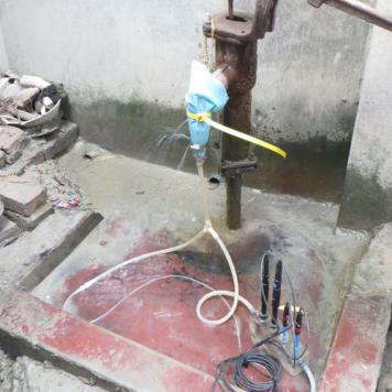
| Influence of human waste on arsenic release into drinking water in Bangladesh | | | | |
| Prähistorische Terrassen im Unterengadin | Bertil Mächtle,
Ingmar Holzhauer | | | |
| Data Management and Data Services | Olaf Bubenzer,
Georg Bareth | SFB 806, subproject Z2, DFG | since 2009 |
| Out of Africa
Late Pleistocene Rock Shelter Stratigraphies and Palaeoenvironments in Northeast Africa | Olaf Bubenzer,
Karin Kindermann,
Ralf Vogelsang | SFB 806, subproject A1 DFG | since 2009 |
| EarthShape – BOFEDAL
Biota’s forcing of earth surface dynamics ascertained on land and sea | Bertil Mächtle,
Karsten Schittek | DFG in the DFG-SPP 1803 „EarthShape“ | | |
| Land unter? – Hochwasser und Hochwasserschutz am Oberrhein während des frühen und hohen Mittelalters | Bertil Mächtle,
Thomas Meier | Fritz-Thyssen-Stiftung | 2016 - 2018 |
| Ausmaß und Alter der westandinen Kordillerenvergletscherung (südliche Provinz Ayacucho / Peru) im Spätpleistozän (LGM bis Jüngere Dryas) | | | | |
| VIKUNIA
Veränderungen in Klimagunst und Naturwahrnehmung im Andenhochland | | Mittel der Universität,
Innovationsfond „Frontier“ im Rahmen der Exzellenzinitiative | | |
| Mensch und Landschaft im Holozän an einer geoökologischen Schlüsselstelle
Geomorphologische Untersuchungen im Raum Vráble, Slowakei | Stefan Hecht,
Gerd Schukraft,
Erich Nowaczinski | | | |
| Palaeodrainage systems, hydroclimatic changes and traditional water use in Egypt and Jordan | Barbara Brilmayer Bakti | Land Baden-Württemberg und Universität Heidelberg | 2009 - 2011 |
| RECAST Urumqi
Ressourceneffizienz als Schlüssel zur nachhaltigen Megastadtentwicklung in Trockenräumen: Urumqi als Modellstadt für Zentralasien | Thomas Sterr,
Katharina Fricke,
Yuan Yao | | | |
| Landschaftsgeschichte und human impact im Umfeld der Schwetzinger Hardt seit dem Würm-Hochglazial | | Universität Heidelberg, Hiehle-Stiftung | | |
| Begraben im Wüstensand
3000 Jahre Mensch und Umwelt an der Seidenstraße | Stefan Hecht,
Bertil Mächtle,
Gerd Schukraft | Mittel der Universität: Exzellenzinitiative – Teilprojekt „Global Networks“ | 2008 |
| Wissenschaftliche Betreuung einer Dachpflanzenkläranlage bei den John Deere Werken Mannheim | | | | |
| URBAN SMS
Soil Management Strategy | | | | |
| Lumineszenzdatierung an Gesteinsoberflächen der wasserwirtschaftlichen Anlagen des Tell Hujayrat al-Ghuzlan, Aqaba, Jordanien | Annette Kadereit,
Christiane Rhodius | Deutsches Archäologisches Institut, DFG | | |
| Anden-Transekt
Klimasensitivität präkolumbischer Mensch-Umwelt-Systeme, Teilvorhaben: Klima- und Umweltgeschichte | Stefan Hecht,
Bertil Mächtle,
Gerd Schukraft,
Markus Forbriger | | | |
| Untersuchungen zur Rekonstruktion des holozänen Klima- und Landschaftswandels und dessen Einfluss auf die bronzezeitliche Kultur im Ida-Gebirge, Zentralkreta | | | | |
| Integrated Flood Hazard, Risk and Vulnerability Assessment in Nyando Basin, Kenya: Options for Land Use Planning | | | | |
| Geoarchäologische Prospektion in Olympia / Griechenland zur Erkundung von prähistorischen Hochwasserschutzmauern | Stefan Hecht,
Gerd Schukraft | Deutsches Archäologisches Institut Berlin-Athen | 2005 |
| Die Ugab-Terrassen in Westnamibia: Datierung mittels kosmogener Nuklide und landschaftsgeschichtliche Interpretation | Bernhard Eitel | DFG | 2005 - 2007 |
| Geoökologische Untersuchungen der Weidenutzung des Araukarienwaldes innerhalb ländlicher Faxinal Siedlungen in Paraná (Südbrasilien) | | Uni Heidelberg,
Hiehle-Stiftung | | |
| Untersuchungen zur Zirkulations- und Ausgasungsfällung von Calcit mit Phosphor-Kopräzipitation am Beispiel des Willersinnweihers in Ludwigshafen | Gerd Schukraft | GRK 273, DFG | 2002 - 2005 |
| Methandynamik in Hartwasserseen am Beispiel des Willersinnweihers in Ludwigshafen | Gerd Schukraft,
Ellen Roberts | GRK 273, DFG | 2002 - 2005 |
| Untersuchungen zur Rekonstruktion der Klima- und Landschaftsentwicklung im Umfeld der ehemaligen Siedlungsflächen der Nazca-Kultur, Peru | Stefan Hecht,
Bertil Mächtle,
Gerd Schukraft | | | |
| Hydrologische Untersuchungen in den Einzugsgebieten des Mantelbachs, Brenkenbachs und Mühlbachs in Dossenheim | Gerd Schukraft,
Heike Wieczorrek | Gemeinde Dossenheim | 2002 - 2005 |
| Kartierung, Datierung und geoökologische Bedeutung der Innterrassen im Bereich des bayerisch-oberösterreichischen Tertiärhügellandes | Holger Megies | Uni Heidelberg,
Hiehle-Stiftung | 2001–2005 |
| Untersuchung, Datierung und paläoklimatische Interpretation von schwemmlössartigen Talfüllungen am Hoanib-River (NW-Namibia) | Bernhard Eitel | DFG | 2001–2004 |
| Gletschergeschichte im Einzugsgebiet des äußeren Woodfjords / Nordwestspitzbergen während des Jungpleistozäns | Holger Megies | DFG | 1999 - 2001 |
| Untersuchung, Datierung und paläoklimatische Interpretation von Schwarzerden in der Trockensavanne Namibias | Bernhard Eitel | DFG | 1998 - 2000 |
| CryoHyd
Veränderungen in der Kryosphäre und deren Auswirkungen auf die Hydrologie | Lucas Menzel,
Li Han,
Munkhdavaa Munkhjargal,
Guyen Battuvshin,
Benjamin Kopp,
Stefanie Minderlein | World Climate Research Programme,
BMBF,
Universität Heidelbeg | | |
| Niedrigwasser, Trockenheit und Dürre
Auswirkungen, Prozesse und Resilienz - Das Unsichtbare sichtbar machen (DRIeR) | Prof. Dr. Lucas Menzel,
Dr. Erik Tijdeman | Ministerium für Wissenschaft, Baden-Württemberg | | |
| Rhein-Transekt:
Langfristige Veränderungen im Wärme- und Wasserhaushalt des nördlichen Oberrheingrabens und angrenzender Gebiete | Lucas Menzel,
Matthias Stork,
Chunyu Dong,
Zhiyong Liu | Bundesland Rheinland-Pfalz | | |
| GLOWA Jordan River Project | Tobias Törnros,
Martina Strakova | | | |
| Spatial and Temporal Resolution Limits for Regional Mass Transport and Mass Distribution (STREMP) | | | | |
| Das hydrologische Modell TRAIN | | | | |
| Wasserhaushalt RP | Lucas Menzel | | Laufend |
| Integriertes Wasserressourcen-Management in Zentralasien
Modellregion Mongolei (MoMo) | | | | |
| Denk(t)räume - Rethinking and doing futures | Prof. Dr. Barbara Mittler,
Prof. Dr. Susann Schäfer | | | |
| DiTh - Digitalisierung in Thüringer Schulen | Susann Schäfer,
Annika Heßmer | | | |
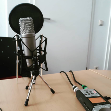
| Podcasts als digitales Prüfungsformat
Implementierung, Begleitforschung und Transfer | Susann Schäfer,
Anika Zorn | | | |
| KlimaKonform II
Gemeinsame Plattform zum klimakonformen Handeln auf Gemeinde- und Landkreisebene in Mittelgebirgsregionen | Susann Schäfer,
Anika Zorn | | | |
| Stille und Lärm in der Stadt in Bezug auf Gesundheit
Forschungsverbund „Tranqulity Studies“ | Susann Schäfer,
Nele Kuhlmann,
Amelie Brockhaus | Friedrich-Schiller-Universität Jena (Exploration Fund) | | |
| WeEco
Women entrepreneurs: An intersectional perspective on entrepreneurial ecosystems in Colombia, Germany and Switzerland | Susann Schäfer,
Isabella Stingl | | | |
| China's Entrepreneurial Ecosystems
New Data Avenues for Entrepreneurial Ecosystem Research-using the Case of China's Entrepreneurial Ecosystems | | | | |
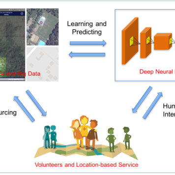
| Harnessing spatiotemporal crowdsourced data
Identify key spatial and behavioral factors that inform the design and delivery of targeted public health interventions as a framework for pandemic preparedness | Till Bärnighausen,
Claudia Denkinger,
Sven Lautenbach,
Alexander Zipf,
Ivonne Morales | | | |
| GeCO
Generating high-resolution CO2 maps by Machine Learning-based geodata fusion and atmospheric transport modelling | Alexander Zipf,
Sanam Vardag,
André Butz,
Sven Lautenbach (Geoinformatik) | | | |
| Climate Change and Health
Improving health care for vulnerable populations in Africa through spatially high-resolution monitoring of the natural and anthropogenic environment | Alexander Zipf,
Till Bärninghausen | Marsilius Kolleg (Exzellenzinitiative) | | |
| Harnessing Data Science for Global Health Priorities in Africa | GIScience Research Group,
HeiGIT gGmbH | | | |
| HEAL
A safe way through the heat – Transdisciplinary project HEAL makes everyday life easier for at-risk groups | GIScience Research Group,
HeiGIT gGmbH | Baden-Württemberg Stiftung | | |
| GeoWiKI
Integrating Geographical Knowledge into Artificial Intelligence | GIScience Research Group,
HeiGIT gGmbH,
Vector Foundation | | | |
| geoEpi
spatio-temporal epidemiology of emerging viruses — leveraging crowdsourced data and occurrence data to improve early disease detection systems | Alexander Zipf,
Sven Lautenbach,
Steffen Knoblauch | | | |
| Project SocialMedia2Traffic
Derivation of traffic information from social media data | Alexander Zipf,
Johannes Fürle,
Christina Ludwig,
Mohammed Zia | | | |
| NACHWUCHS
Nachhaltiges AgriUrbanes ZusammenWachsen | | | | |
| HCE: Klimahandeln fundiert gestalten
Fallstudie Baden-Württemberg/Kalifornien | Tessio Novack,
D. Hauck,
Alexander Zipf | | | |
| IDEAL-VGI
Information Discovery from Big Earth Observation Data Archives by Learning from Volunteered Geographic Information | Alexander Zipf,
Sven Lautenbach,
Michael Schultz,
Moritz Schott | | | |
| meinGrün
Information and navigation on urban green spaces in cities | Alexander Zipf,
Sven Lautenbach,
Christina Ludwig,
Judith Levy,
Tessio Novack | Federal Ministery for Transport and Digital Infrastructure | | |
| | Alexander Zipf,
Carolin Klonner,
Mohammed Rizwan Khan | | | |
| DeepVGI
Deep Learning with Volunteered Geographic Information | | | | |
| | Robin Peters,
Tessio Novack,
Sven Lautenbach,
Alexander Zipf | | | |
| | | | | |
| OSM Landuse/Landcover Karte über Landnutzungsinformationen basierend auf OpenStreetMap | Alexander Zipf,
Michael Schultz | | | |
| | Alexander Zipf,
Carolin Klonner | | | |
| OpenStreetMap Exposure & Vulnerability datasets to support risk assessment | Alexander Zipf,
Mohammed Zia | | | |
| Heterogeneity and Convergence in Shared Data Sources
The Importance of cognitive Coherence in Collective Decision Making | Daniel W Heck,
Franz-Benjamin Mocnik | | | |
| Accessibility Routing | | | |
| LandSense
A Citizen Observatory and Innovation Marketplace for Land Use and Land Cover Monitoring | | | | |
| GeoNet.MRN
Netzwerk – Geoinformation der Metropolregion Rhein-Neckar | | | | |
| HeiMAP
der virtuelle Kartentisch | | | | |
| Campus Mobil – Routing and Navigation (extending ORS) | | | | |
| WeGovNow
Towards We-Government: Collective and participative approaches for address local policy challenges | Alexander Zipf,
Alexey Noskov,
Adam Rousell | | | |
| Zur agentenbasierten und qualitätsbewussten Integration von Daten aus geo-sozialen Netzwerken
Datenintegration als gemeinschaftlicher Verhandlungsprozess | | | | |
| Quantifizierung der räumlichen Korrelationsstrukturen in georeferenzierten Twitter Feeds | Alexander Zipf,
René Westerholt | | | |
| | Hongchao Fan,
Alexander Zipf | | | |
| HCE
Klimahandeln fundiert gestalten – Fallstudie Heidelberg/Rhein-Neckar-Kreis | Katharina Przybill,
Sven Lautenbach,
Kathrin Foshag,
Julius Hoderlein,
Nicole Aeschbach | | | |
| | | | | |
| Aufbau des “Heidelberg Institute for Geoinformation Technology” | | | | |
| LingOSM
Identifying the Cultural and Linguistic Influence on Mapping Behaviour | | | | |
| CrowdFDA
Crowdsourcing for Forensic Disaster Analysis | | | | |
| Urban Emotions
Methodenentwicklung zur Gewinnung von Kontextuellen Emotionsinformationen für die Räumliche Planung auf Basis von Echtzeit-Humansensorik und Crowdsourcing-Ansätzen in Sozialen Netzwerken | | | | |
| Räumliche Optimierung von Energiespeichern
Werkzeuge zur Potenzialanalyse und Strukturoptimierung von Speichern in regionalen Energiesystemen | | Baden-Württemberg Programme | | |
| An Integrated Web-Based Information And Analysis System For Historic Geodata: The Case of Lloyd's Lists | Alexander Zipf,
Amin Mobasheri | | | |
| ENERGIC
ICT COST Action IC1203 European Network Exploring Research into Geospatial Information Crowdsourcing: software and methodologies for harnessing geographic information from the crowd | | | | |
| Klaus-Tschira Incubator Research Groups "Advancing GIScience" | | | |
| Disaster Mapping 2.0
Collaborative Geographic Information Systems for Building Resilience against Disasters | João Porto de Albuquerque | | | |
| CAP4Access
Collective Awareness Platforms for Improving Accessibility in European Cities & Regions | Alexander Zipf,
M. Bakillah,
Stefan Hahmann | European Research Comission | | |
| AGORA
A Geospatial Open collaborative Architecture for Enhancing Public Awareness about Environmental Risks and Subsidizing Disaster Management | João Porto de Albuquerque | Alexander von Humboldt Stiftung | | |
| Open Flood Risk Map
A decision support system based on user-generated spatial data for communities in support of emergency response planning in flood management | | | | |
| Generating Knowledge for the City
New methods of public partcipation through interactive urban planning with Web 2.0 technologies. The case of the energy turn | | | | |
| HistOSM
Historic WebMapService of Europe | | | | |
| OpenStreetMap 3D Global
Bringing OpenStreetMap to the 3rd Dimension – Global 3D Web Service | | | | |
| MayaArch3D
A web-based 3D-GIS for analysing the archaeology of Copan, Honduras | | | | |
| Mobility Data Marketplace (MDM)
Derivation of an OSM graph with TMC LCL information to provide real time traffic services in collaboration with Straßen NRW and the German federal road agency (BAST) | Alexander Zipf,
Enrico Steiger,
Pascal Neis | | | |
| People as Sensors and Collective Sensing
Real-time Geo-Analysis and Visualisation of Urban Processes | | Excellence Initiative II - Mobility in International Research Collaborations | | |
| osmAGENT
How Good Can Agent-Based Modeling Predict OpenStreetMap Data? | | | |
| GDI 3D – Heidelberg 3D
3D spatial data infrastructure for the city of Heidelberg | | | | |
| Data quality assurance in web-based citizen science systems for occurrences of local fauna and flora (biodiversity) collected by volunteers | Alexander Zipf,
Clemens Jacobs | | | |
| OSMatrix | | | |
| GDI_2.0
Zur Erweiterung von 3D-GeoDatenInfrastrukturen | | | |
| TeleAgro+
Evaluation of agricultural telematics data to improve business processes and optimize agricultural logistics | Johannes Lauer,
Ludwig Richter,
Sen Sun,
Timothy Ellersiek | | | |
| SucaP
Strategi urban area aggregation and caricature project | | | | |
| Lithium in drinking water and prescriptions effects on suicide mortality | Nestor Kapusta,
Marco Helbich
Michael Leitner | | | |
| RIgeo.net
Raumbezogene Analysemöglichkeiten zur Unterstützung historischer Forschung am Beispiel der Regesta Imperii | | | | |
| GRIPS
GIS basiertes Risikoanalyse-, Informations- und Planungssystem für die Evakuierung von Gebieten
Agenten-basierte Evakuierungssimulation | Mohammed Bakillah,
Amin Mobasheri | | | |
| | | | | |
| 3D-Sutren
Interaktive Analysewerkzeuge für einen Atlas gescannter Sutratexte | Alexander Zipf,
Bernhard Höfle | | | |
| HyLand
Nutzung hyperspektraler Fernerkundung zur Bereitstellung landwirtschaftlicher Boden- und Pflanzenparameter für Precision Farming und Ertragsprognosen | | | | |
| XNavigator W3DS-Client | | | |
| EU Project BLAST
Bringing Land and Sea Together: Web-based 3D Visualization of Climate Change for EU Project BLAST | | ERDF,
Interreg EVB North Sea Region Programme | | |
| Data Mining of Crime Information from the General Public | Marco Helbich,
Alexander Zipf,
Julian Hagenauer | | | |
| 3D PIE
OGC 3D Portrayal Interoperability Experiment | | | | |
| Predictive Accuracy of Large-Scale Spatial Hedonic Price Models Using Laser Scanning Data | | Alexander von Humboldt Foundation | | |
| GI_Testbed
OGC-EUROSDR-AGIlLE persistent test bed for Europe | | | | |
| Abgrenzung urbaner Räume mittels OpenStreetMap und maschinellen Lernverfahren | | | | |
| Interoperable Focus Maps with OSM data | | | |
| GEOSS
Global Earth Observation System of Systems | | | | |
| LOGIS/SIMSAS
Security Information Management and Security Analysis System | | | | |
| 100 Gründe hinauszugehen
Serviceplattform für Ziele und Wege im Stadtteil speziell von und für Menschen ab 60 | | | | |
| Erkennung und Nutzung von Landmarken in der 3D-Navigation | | | |
| SLD-Explorer – the Online OGC SLD-Editor | | | |
| OWS-6
OGC Web Services Phase 6 | | | | |
| | | | | |
| | | | | |
| Delhi Transit Routing Pilot Interoperability Initiative "DTRIP" | | | | |
| GDI-Grid
Geodateninfrastruktur-Grid | | | |
| FreeOpenLS.org | | | |
| OK-GIS
Offenes Katastrophenmanagement mit freiem GIS | | | |
| 3DGisMarkt.de | | | |
| Integration of Wind Simulation Models in 3D City Models | | | |
| Historic Information System for the Germany States 1815-1938 | | | |
| ImmoSDSS
A Web Spatial Decision Support System for the real estate market in RLP. | | | |
| Base Map Francfort Airport Online.
FRAPORT AG. | | | |
| GeoExchange.org
A geoportal for eXchanging Free geodata | | | |
| NOAH
International Flood Information and Warning System
(FLIWAS; Consultant) | | | |
| Advicer for EML within the BMBF project Advancement of Geoservices | | | |
| A web-based Flood Information System for the KABS
Kommunale Aktionsgemeinschaft zur Bekämpfung der Schnakenplage | | | |
| A web-based Economic Atlas for France
Co-Operation with SUPdeCO Montpellier, France | | | |
| MoNa3D
Mobile Navigation 3D | | | |
| SmartKom
BMBF-lead project on Human-Computer-Interaction Multi-Modal Mobile Assistance and Navigation System | | | |
| CRUMPET
„CReation of User-friendly Mobile services PErsonalized for Tourism“; (LBS) EU-Project; 5th. Framework; IST | | | |
| | | | | |
| TrafU
Transformative Umweltforschung | Nicole Aeschbach,
Naomi Held | | | |
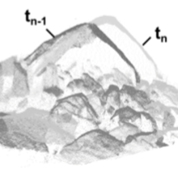
| 4D Objects-By-Change
Change Analysis of Natural Surfaces using 3D Time Series | Katharina Anders,
Bernhard Höfle,
Lukas Winiwarter | | | |
| M3C2-EP
Error propagation for topographic 3D change detection | Katharina Anders,
Bernhard Höfle,
Lukas Winiwarter | | | |
| Multi-Directional 3D topographic change | Katharina Anders,
Bernhard Höfle,
Veit Ulrich,
Jack G. Wiliams,
Lukas Winiwarter,
Vivien Zahs | | | |
| 3DForEcoTech
Three-dimensional forest ecosystem monitoring and better understanding by terrestrial-based technologies | | COST - European Cooperation in Science & Technology (seit 2021) | | |
| | Katharina Anders,
Bernhard Höfle,
Lukas Winiwarter | | | |
| Extract4D
Generalized Extraction of Surface Dynamics from Multimodal 4D Point Clouds for Topographic Monitoring of Earth Surface Processes and Their Interactions | | | | |
| Fostering a community-driven and sustainable HELIOS++ scientific software | Bernhard Höfle,
Hannah Weiser | | | |
| HELIOS++
Heidelberg LiDAR Operations Simulator | Bernhard Höfle,
Alberto Manuel Esmorís Pena (Catallactical S.L., ES),
Dominic Kempf (SSC),
Ronald Tabernig,
Hannah Weiser,
Lukas Winiwarter (University of Innsbruck, AT) | | | |
| Virtualearn3D
Virtual Laser Scanning for Machine Learning Algorithms in Geographic 3D Point Cloud Analysis | Bernhard Höfle,
Hannah Weiser | | | |
| AImon5.0
Real-time monitoring of gravitational mass movements for critical infrastructure risk management with AI-assisted 3D metrology | Bernhard Höfle,
William Albert,
Ronald Tabernig | | | |
| CharAct4D
Unravelling Landscape Dynamics via Automatic Characterization of Surface Activity using Geographic 4D Monitoring | Katharina Anders (TU Munich),
Bernhard Höfle,
Maria Federer (TU Munich),
Vivien Zahs | Baden-Württemberg Stiftung | | |
| E-TRAINEE
E-learning course on Time Series Analysis in Remote Sensing for Understanding Human-Environment Interactions | Bernhard Höfle,
Katharina Anders,
Sina Zumstein | Erasmus+ Programme of the European Union | | |
| AHK-4D
High-resolution and high-frequency monitoring of the rock glacier Äußeres Hochebenkar (AHK) in Austria | Bernhard Höfle,
Ronald Tabernig,
Hannah Weiser | | | |
| LOKI
Airborne Observation of Critical Infrastructures (Luftgestützte Observation Kritischer Infrastrukturen) | | | | |
| SYSSIFOSS
Synthetic structural remote sensing data for improved forest inventory models | Bernhard Höfle,
Nina Krašovec,
Hannah Weiser,
Lukas Winiwarter | | | |
| ER3DS
Emission Reduction in Smart Cities Using 3D Spatial Sensing and Analysis | Nicole Aeschbach,
Katharina Anders,
Bernhard Höfle,
Lukas Winiwarter,
Vivien Zahs | | | |
| Auto3Dscapes
Autonomous 3D Earth Observation of Dynamic Landscapes | Katharina Anders,
Bernhard Höfle,
Hubert Mara,
Thomas Scharffenberger | | | |
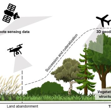
| Ruderalization and invasive species spread as a consequences of land abandonment in European landscapes after 1990: detection and assessment using remote sensing | Katharina Anders,
Bernhard Höfle,
Zhaleh Siabi | 4EU+European University Alliance | | |
| Towards sustainable development of natural environments based on continuous remote sensing monitoring | Bernhard Höfle,
Katharina Anders,
Lukas Winiwarter,
Vivien Zahs | 4EU+ European University Alliance | | |
| Farmland abandonment in Europe
Establishment of network for testing novel data sets and methods to monitor the patterns and evaluate its drivers | Katharina Anders,
Bernhard Höfle,
Sylvia Pscheidl | 4EU+European University Alliance | | |
| GEODYNAMO4D
Tracing geographic dynamics on 4D Point Clouds | Bernhard Höfle,
Lukas Winiwarter | | | |
| Geomorph4D
Characterising multi-process geomorphic change through high spatial- and high temporal-resolution monitoring | Bernhard Höfle,
Jack G. Williams,
Vivien Zahs | | | |
| HELIOS
Heidelberg LiDAR Operations Simulator | Bernhard Höfle,
Niko Lucač,
Jorge Martínez Sánchez,
Alberto Manuel Esmorís Pena,
Katharina Anders,
Lukas Winiwarter,
Hannah Weiser,
Mark Searle | | | |
| Landcover monitoring
with emphasis on vegetation under the climatic change pressure using multitemporal and multisource remote sensing data fusion | | 4EU+ European University Alliance | | |
| PermaSAR
Development of a Method to Detect Subsidence by Means of D-InSAR in Permafrost Regions News | Julia Boike,
Inga Beck,
Sabrina Marx,
Katharina Anders | | | |
| NEOHAZ: NEOgeography of a Digital Earth
Geoinformation Science as Methodological Bridge in Interdisciplinary Natural HAZard Analysis (NEOHAZ) | Michael Hölscher,
Carolin Klonner,
Sabrina Marx,
Tomás Usón | | | |
| 3D-TAIGER
Multi-Source 3D Geoinformation Extraction for Improved Management of Forest and Natural Hazards – Collaboration between TAIwan and GERmany | Ming-Chee Wu,
Chi-Kuei Wang,
Kristina König,
Martin Hämmerle | | | |
| 4DEMON
4D Near Real-Time Environmental Monitoring | Dirk Hoffmeister,
Martin Hämmerle,
Evelyn Schmitz | Ministry of Science, Research and Arts, Baden- Wuerttemberg | | |
| 3D-MAPP
3D-MicroMapping of Big 3D Geo-Datasets in the Web | Benjamin Herfort,
Florian Hillen,
Marcel Kaibel | | | |
| PhD Graduate School: CrowdAnalyser
Spatio-temporal Analysis of User-generated Content | Alexander Zipf,
Michael Gertz,
Björn Ommer | Landesgraduiertenförderung Baden-Württemberg | | |
| LS-VISA
3D Laser Scanning – Vegetation Investigation and Signature Analysis | Kristina König,
Andreas Kiefer,
Luisa Griesbaum,
Zsófia Koma | | | |
| MUSIEKE
Multidimensional Perceptibility of Cultural Heritage | Christian Witschel,
Caroline Y. Robertson von Trotha,
Alexander Zipf,
Stefan Hinz,
Thomas Vögtle,
Hubert Mara,
Ralf Schneider | | | |
| Teaching Excellence Grant
3D GIScience Methods for Geographic Analysis | Bernhard Höfle | MWK-BW | 2014 |
| Landscape and Climate Change in the Last 2000 Years in the Altmühltal/Bavaria | Cooperation with Environmental Physics and Institute of Pre- and Early History | DFG | 2013–2014 |
| Climate Impact on Malnutrition
a Geospatial and Public Health Approach | Cooperation with Institute of Public Health | DFG | 2013–2014 |
| ESOB
Multi-sensor technology for the optimization of plant production ratings | Martin Hämmerle,
Sabrina Marx,
Larissa Müller,
Fabian Schütt | | | |
| BarSolPot
Nationwide cadaster for the solar potential of photovoltaic systems on noise and wildlife barriers | Sabrina Marx,
Sudhanshu Shekhar,
Andreas Reimer | | | |
| HedALS
Predictive Accuracy of Large-Scale Spatial Hedonic Price Models Using Laser | Marco Helbich,
Andreas Jochem | Alexander von Humboldt Foundation | 2011–2013 |
| Global Network
Airborne Laser Scanning for 3D Vegetation Characterization: Set-up of an International Signature Database | | | | |
| HyLand
Hyperspectral Remote Sensing for Precision Farming | Cooperation with University Osnabrück,
Technichal University Munich,
Julius-Kühn-Insitute Braunschweig | BMWi & DLR | 2010–2013 |
| SFB 1671: Heimat(-en)
Phänomene, Praktiken, Darstellungen | Ulrike Gerhard,
Shasha Lin,
Editha Marquardt | | | |
| C-NEWTRAL Doctoral Network | Ulrike Gerhard,
Alireza Aboutalebi Adergani | | | |
| Autorität und Vertrauen in der Amerikanischen Kultur, Gesellschaft, Geschichte und Politik | Ulrike Gerhard,
Judith Keller,
Anthony Meluso,
Julia Schinnenburg | | | |
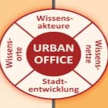
| Urban Office
Einrichtung eines Reallabors “Nachhaltige Stadtentwicklung in der Wissensgesellschaft” | Prof. Dr. Ulrike Gerhard,
Dr. Editha Marquardt | | | |
| Mittendrinnenstadt
Zukunftsfähige Innenstädte und Zentren | Ulrike Gerhard,
Carla Jung-König,
Anne Morlock,
Marc Heptig,
Magnus Mangold | | | |
| PHV zwischen Wissenschaft und Praxis | | | | |
| Unequal Access to Public Transportation and Restrictions on Equal Mobility | Hamid Alberto Abud Russell | | | |
| Community Building in Mixed-Use Areas of Toronto | Bariah Altaf Qadeer | Dissertationsprojekt | 2020 - 2023 |
| Migration Across the Americas | Ulrike Gerhard,
Yaatsil Guevara Gonzáles | | | |
| Flagship 1
“Urban Health and Demographic Change” / 4EU+ Alliance | Ulrike Gerhard,
Editha Marquardt,
Jens Schneider | | | |
| Reallabor Asylsuchende in der Rhein-Neckar-Region | Dr. Christina West, Prof. Dr. Havva Engin (PH Heidelberg), Svenja Kück | Ministerium für Wissenschaft, Forschung und Kunst Baden-Württemberg | | |
| Jenseits von Nord und Süd –Vergleichende Stadtforschung aus interdisziplinärer Perspektive | Ulrike Gerhard, Christiane Brosius, Katja Patzel-Mattern | | | |
| Mobile Räume: Urbane Alltagspraktiken aus transkultureller Perspektive | Ulrike Gerhard, Editha Marquardt, Christiane Brosius, Beatrix Busse, Marie Sander | Field of Focus 3, Exzellenzinitiative | | |
| Partizipation und Stadtentwicklung – Zur Bedeutung von Bürgerbeteiligung in der Wissensgesellschaft | | | | |
| Willkommen in der Wissenschaft – studentische Forschungsprojekte zur interdisziplinären Stadtforschung | Ulrike Gerhard, Editha Marquardt, Michael Hölscher, Studierende der Geographie und Soziologie | Innovations- und Qualitätsfonds (IQF) des Ministeriums für Wissenschaft, Forschung und Kunst Baden-Württemberg | | |
| Nachhaltige Stadtentwicklung in der Wissensgesellschaft. Ein Konzept zur Wissenschaftlichen Begleitforschung im Rahmen der Internationalen Bauausstellung Heidelberg | Ulrike Gerhard, Editha Marquardt | Stadt Heidelberg, IBA GmbH | | |
| Educational Inequality for Migrant Children | | China Scholarship Council (CSC) | | |
| Negotiating Social Life and Learning in cON/FFlating Spaces
A Comparative Study of University Students in Malaysia and Austria | Tabea Bork-Hüffer,
Alexander Trupp | Federal Ministry Republic of Austria Education, Science and Research (ASEA-UNINET) | | |
| Entanglements, Dis_Abilities and Inclusion in Public Spaces (Enabling Spaces) | Tabea Bork-Hüffer,
Johannes Melchert,
Jan Misera | | | |
| beYOND:
Young People Negotiating Difference in cON/FFlating Spaces | Tabea Bork-Hüffer,
Katja Kaufmann | | | |
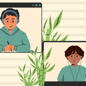
| Mixed Methods Study on Distance Learning during the COVID-19 Pandemic | Barbara Juen,
Tabea Bork-Hüffer | | | |
| Young Adults in the COVID-19 Pandemic (COV-IDENTITIES) | Tabea Bork-Hüffer,
Katja Kaufmann | | | |
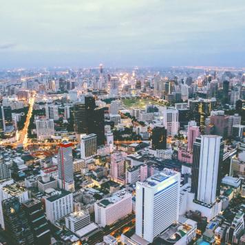
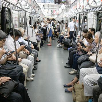
| The Making of Transient Urban Spaces in the Bangkok Metropolitan Region (BMR) | Tabea Bork-Hüffer,
Simon A. Peth | ASEAN-European Academic University Network (ASEA-UNINET) | | |
| Digital Geographies – Geo data – Code – Society | Christian Bittner,
Tabea Bork-Hüffer,
et al. | | | |
| The Digital, Affects and Space (DigitAS) | Tabea Bork-Hüffer,
Katja Kaufmann,
Niklas Gudowsky,
Martin Rutzinger | | | |
| Internal and International Migrant Communities in the Pearl River Delta, China
Linking Informal Migration Dynamics, Global Change and Urban Health | Frauke Kraas,
Bettina Gransow,
Tabea Bork-Hüffer | | | |
| Patterns of Migrant Community Formation in China’s Megaurban Pearl River Delta (PRD) | Frauke Kraas,
Bettina Gransow,
Tabea Bork-Hüffer | | | |
| New Media, Migration and the City: A Cross-cultural Comparison of Chinese, Filipino and German Professionals in Singapore | | | | |
| Formation and Change of Migrants’ Notion of Place Under the Influence of Information and Communication Technologies and Glocalization | | | | |
| Lake Ganau in the Rania Plain in Iraqi Kurdistan – a new limnic archive for palaeoenvironmental studies and the investigation of man-environment interaction | Prof. Manfred Rösch,
Dr. Simone Mühl,
Ludwig Maximilians,
Dr. Annette Kadereit | | | |
| Underwater caves (Cenotes) on Yucatan | Prof. Wolfgang Stinnesbeck,
heiLUM-Team | | | |
| The Shahrizor Survey Project | Dr. Simone Mühl,
heiLUM-Team | | | |
| Holozäne Landschaftsentwicklung der Donauaue in der Umgebung des kupferzeitlichen Tells Pietrele, Rumänien | Prof. Jürgen Wunderlich,
Dirk Novacki,
heiLUM-Team | | | |
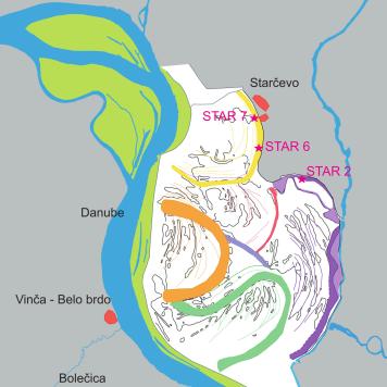
| Palaeoenvironment and fluvial history of the river Danube between the Neolithic settlement sites Vinca and Starcevo, Serbia | Prof. Josef Maran,
Kristina Penezic,
Prof. Heinrich Thiemeyer,
heiLUM-Team | DAAD (Stipendium Kristina Penezic) | | |
| Wadi Sura II - Cave of the Beasts | Prof. Olaf Bubenzer,
Dr. Rudolph Kuper,
Dr. Heiko Riemer,
heiLUM-Team | | | |
| Aqaba, Jordanien – Tall Hujayrat al-Ghuzlan | Prof. Dr. phil. Ricardo Eichmann,
PD Dr. Klaus Schmidt,
heiLUM-Team | | | |
| Neolithisch-kupferzeitliche Tellsiedlung bei Uivar/Rumänien | Prof. Dr. Wolfram Schier,
heiLUM-Team | | | |
| Landschaftsarchäologie Glauberg. Untersuchungen im territorialen Umland des Glaubergs: Zur Genese und Entwicklung eines Fürstensitzes in der östlichen Wetterau. | Prof. Dr. Christopher Pare,
heiLUM-Team | | | |
| Neue naturwissenschaftliche Technologien in den Geisteswissenschaften (NTG) | Günther A. Wagner,
heiLUM-Team | | | |
| Untersuchung, Datierung und paläoklimatische Interpretation von schwemmlössartigen Talfüllungen am Hoanib-River (NW-Namibia) | Bernhard Eitel,
W. D. Blümel,
K. Hüser,
heiLUM-Team | | | |